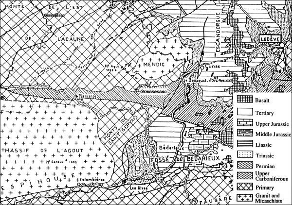
Geological map of the Basin of Graissessac. After Gand et al (2001).
The coal basin of Graissessac is an elongated syncline (a downward-curving fold, with layers that
dip towards the center of the structure) with average dimensions of 22 km and 3 km.
The basin is east west oriented and dips on the east side under the Permian basin of Lodève.
To the south the basin is bordered by fractures.